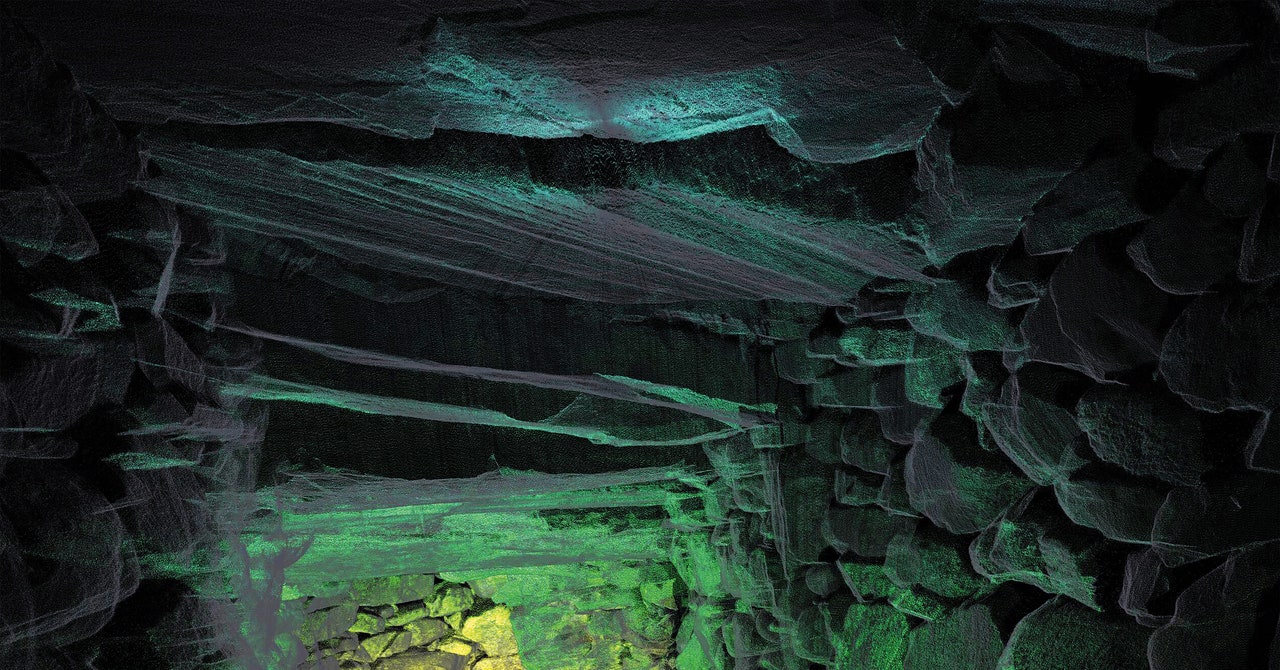
In February 2022, Graeme Cavers and his team of archaeologists set off in search of a mysterious underground passage called a souterrain. There are around 500 of these Iron Age structures scattered throughout the Scottish Highlands, but nobody knows what they were built for, and no one has ever discovered one intact.
“Perhaps they were for storage, such as grain in sealed pots or dairy products like cheese,” says Matt Ritchie, resident archaeologist at Forestry and Land Scotland. “Perhaps they were for security, keeping valuables safe, or slaves or hostages secure. Or perhaps they were for ceremonial purposes, for household rituals, like a medieval shrine or private chapel.”
Site surveys can help shed light on the condition and structure of souterrains, but they can take at least a week using traditional methods, says Cavers, whose company AOC Archaeology was enlisted by Ritchie to help map the Cracknie Souterrain in Scotland’s Borgie Forest.
Manual measurements using a device called a theodolite—difficult to use in dark, cramped tunnels—have been replaced by laser scanners, which have improved markedly in the past few decades. “They used to connect to an external laptop,” Cavers says. “The data could only be recorded as fast as that connection. It was done over an Ethernet cable, so it was relatively fast. But even then, the first laptops that I used with a scanner had 2 gigabytes of RAM. That was top of the range. And a laptop cost an awful lot of money in those days.”
The tech has developed a long way since then. After crawling into the Cracknie Souterrain through a 50-centimeter opening in the ground, Cavers was handed a gray device the size of a shoebox: a Leica BLK360 laser scanner.
Cavers set the device on a tripod in the dank 1-meter-high passage, adjusted a few settings, and pressed “scan.” It swiveled into action, firing a laser against the walls of the souterrain 10,000 times a second. Cavers and his team can now take millions of measurements in under an hour without lifting a finger—Cracknie yielded 50 million in just a few hours. “To do the equivalent of what we did with a theodolite, you would be there a long time,” Cavers says.
Collecting large data sets presents a challenge in itself. “Today, we’re coming back with half a terabyte” of data, he says. “And we might do a couple of hundred projects in a year. It starts to get very difficult to manage from an IT point of view. And obviously we’re archaeologists; we’re supposed to be creating archives that are perpetual, for the long term.”
The data does, however, pay its dues. Cavers would have once had to draw or photograph the souterrain from within the dark passageway, which would have challenged his perseverance without any natural light. Now he uses software—Trimble RealWorks, NUBIGON, and Blender—to produce accessible 3D multicolored “point cloud” models.
The team members can then look at the models from any angle they like and measure distances between any two objects, and they can change the colors according to variables such as height and density. It means archaeologists like Ritchie can teach people about archaeological sites without having to actually go there.
“[Cracknie] is very remote,” Ritchie says. “It’s a long way from established walking routes and is relatively difficult to access.” That means it’s poorly suited to guided tours or educational panels—but a 3D model can be viewed from anywhere. Ritchie could even print out a scale model and display it in a museum. The technology is making Britain’s cultural heritage more accessible, and might one day help archaeologists like Ritchie solve the mystery of Scotland’s souterrains.
This article was originally published in the January/February 2023 issue of WIRED UK magazine.


